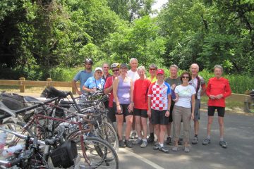
Wednesday, June 8, 2016
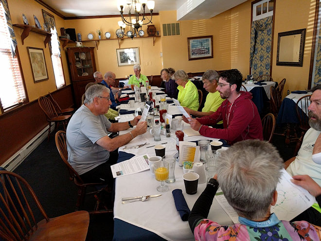
Today was our last 50+ mile day of the tour, and would be another full day since the hotel dining room didn’t open for breakfast until 8AM and then we had to return to Hancock to pick up our bikes. Everybody was there when the doors opened, and we were rewarded with a nice order-from-a-menu full breakfast. While getting ready to leave, we were also checking our smartphones to see if that last line of storms would bypass us again, but were also anxious to get going since we had a number of side trips and trail attractions to see along the way.
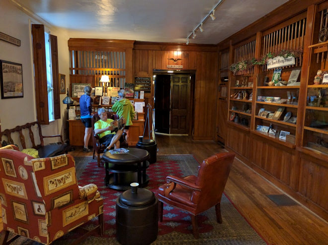
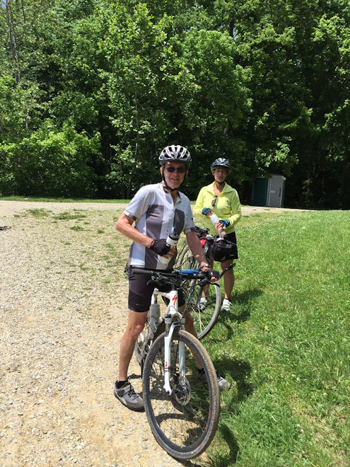
Well, it didn’t quite miss us, as we had a brief downpour just as Dave and Taylor were fetching our bikes and checking the tires and chains. We let them get wet while the rest of us stayed in the van or looked around inside the bike shop, where I picked up a nice pair of full-finger gloves that I needed. By the time we were actually ready to start, the rain had stopped, although it was certainly wetting down the trail that we were going to be on. The good news was that this was the last threat of rain for the entire trip, and from there on we had a lot more sun and warm temperatures.
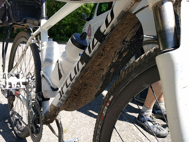
As we started out again on the pavement of the Western Maryland rail-trail, I considered how well my bike and equipment had been doing so far. Based on my problems in 2012, I had replaced that bike shortly thereafter with a Specialized Crosstrail with hybrid-style 700c wheels and hydraulic disc brakes. The 700×38 tires don’t have a very aggressive tread pattern for off-road use, but had done very well in the muddy sections without ever sliding out or getting squirrely in any way. The mudguard was doing its job, and with any luck the bike wouldn’t require more washing on this trip. Having the right stuff certainly makes a ride more enjoyable!
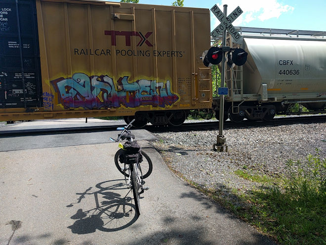
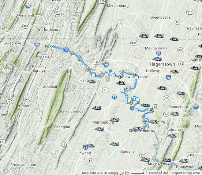
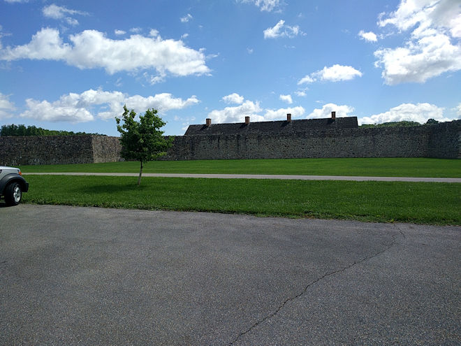
Our first support stop was slightly up from the trail at the historic site of Fort Frederick State Park. The fort is one of the oldest military forts still in existence in this country, going back to the mid-1700s. For a few minutes I wasn’t sure I’d get to the stop since a crossing freight train had stopped on the tracks in front of me, but within a few minutes it started moving again and I was able to join the others.
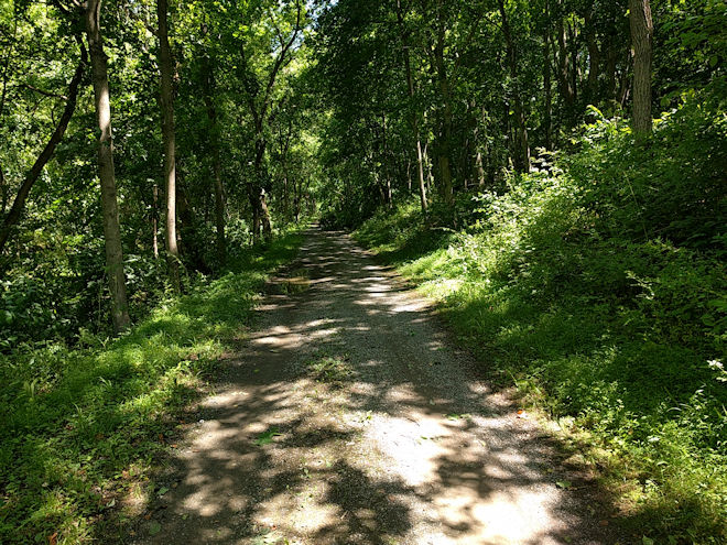
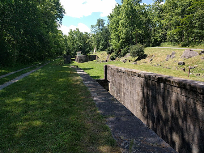
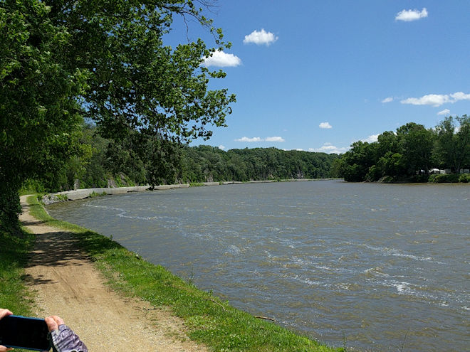
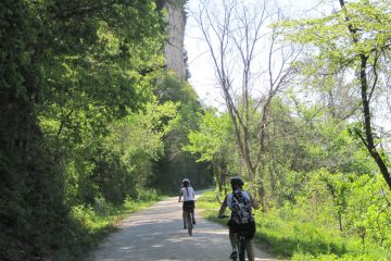
From this point on, the towpath took on its familiar sameness that can frankly be a bit monotonous. The trail is mostly under a canopy of trees, which keeps it shady (and wet!), and with its gently curving path you usually can’t see all that far ahead or behind. The canal itself is always on the left and varies in appearance: sometimes it is a ditch that obviously used to be a canal; at other times it has grown in so much with trees and brush that it’s hardly recognizable; and in some places it has water in it. Likewise the many locks vary in their condition from only a few remnants to ones that have been restored and still have the keeper’s house in good order. On the right is the Potomac River, but since the distance of the canal from the river varies, it is not always readily visible. The river does move along very swiftly, though, and increases in width and volume as you progress downstream.
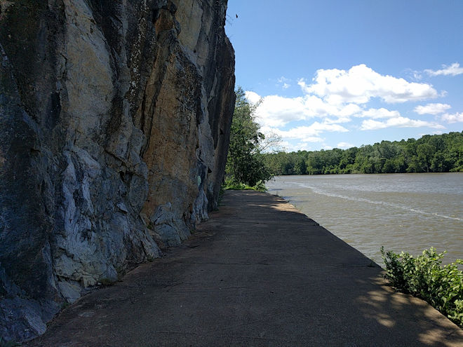
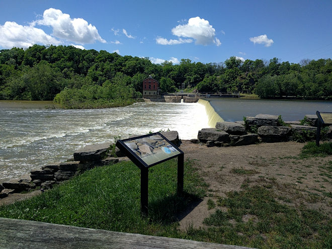
Our next place of interest was “Little Slackwater,” where the trail goes around a cliff on a concrete ledge. There are a couple of places on the canal route where the cliffs come almost to the edge of the river and it would have been almost impossible to construct a canal and towpath along them. So what they did was to dam up the river lower down to create an artificial widening or lake where the current would be less (thus the term “slackwater”) and float the canal boats through that section from a towpath at the base of the cliffs. The problem for the trail is that subsequent floods and erosion have wiped out the original narrow towpath and they’ve had to replace it with something more permanent. This first slackwater path, some of which had been carved out of the side of the cliff, was short and just past it we saw Dam 5, which was constructed to create the slackwater and has since been converted to supply hydroelectric power. Signage also told of several attacks on the dam by the Confederate forces during the Civil War, since destroying the dam would effectively have put the canal out of service. Fortunately they never succeeded.
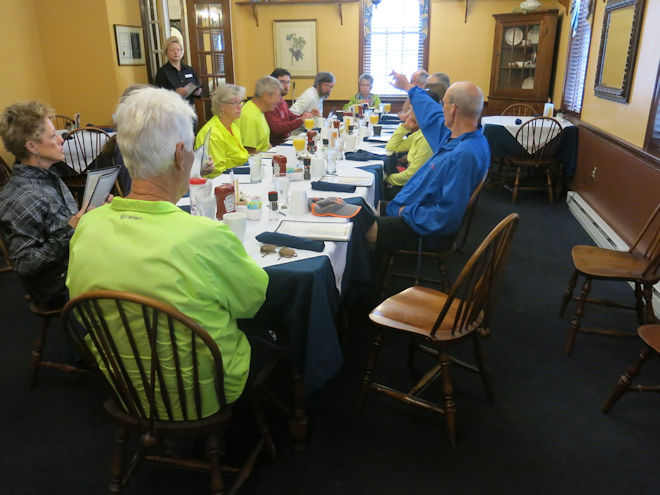
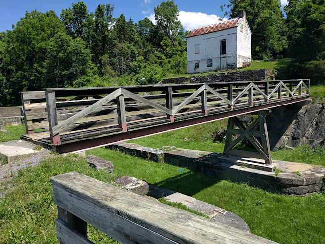
Lunch was in Williamsport, which in former times was the largest port right on the central part of the canal route and was actually its terminus from when the canal reached there until it was eventually completed all the way to Cumberland. The town’s proximity to Hagerstown made it a major port for transferring goods in and out of the area, and it was quite prosperous while the canal era lasted. There was a canal museum across the lot from where we had lunch, which had some interesting exhibits including a large scale 3-D topographic map of the canal’s entire length.
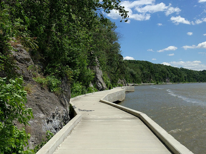
A few miles out of Williamsport, we got to the new “Big Slackwater” section. This long slackwater towpath was out of commission for a number of years, and in 2012 we had to take a rather unpleasant road bypass to get around it. But just this year the new pathway was completed and it is one of the more spectacular sections of the trail: 2.7 miles of purpose-built concrete causeway above the river and below the cliff. It was really cool to ride, but not a place to ride side-by-side or chance meeting someone coming wide around an oncoming corner! None of this was helped any by the very strong crosswinds we were getting for the entire second half of the day. In the end, though, the winds helped a lot in drying out the last remnants of mud along the trail.
At the next support stop, plans were made to get everyone to the Antietam National Battlefield Park, which was the final attraction before getting to the hotel. Again, in 2012 we had to ride from the canal to the park on hilly public roads, and afterward ride on fairly busy roads to the hotel. This time the plan was to meet at a convenient place a few miles down the trail, load the bikes up, and drive everyone to the battlefield and from there to the hotel. This actually skipped about 15 miles of trail, and since I had been to Antietam several times previously, I opted to just ride it out all the way to Shepherdstown. I was the only one who did so and had a leisurely — albeit windy — 15-mile “unsupported” ride along the towpath trail until I got to the bridge at Shepherdstown. From there it was up a set of switchbacks to road level, across the bridge, and right into the Bavarian Inn.
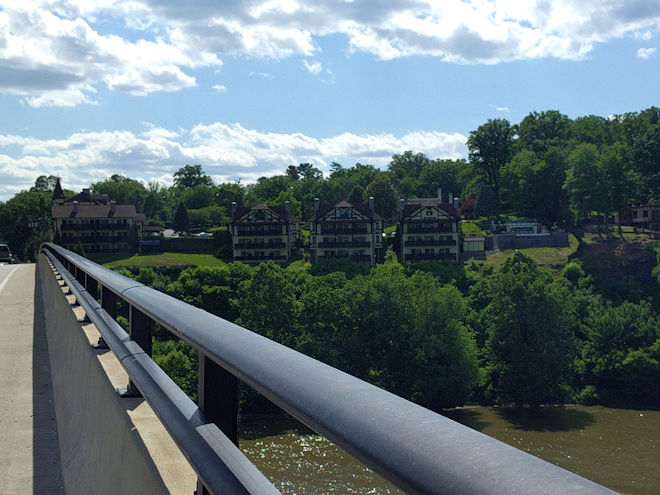
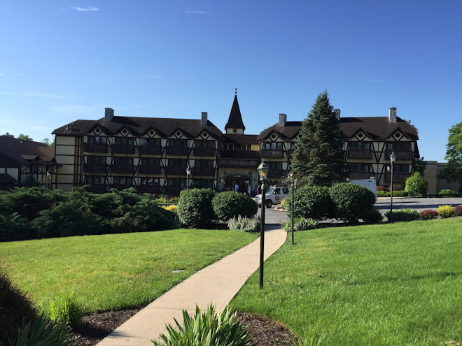
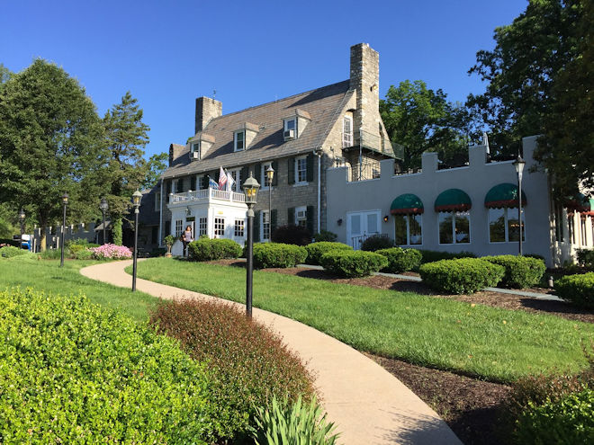
The Bavarian Inn is probably the best, if not the only full-service hotel between Cumberland and Georgetown that is directly accessible from the trail. As a result, it caters to and is visited by numerous cyclists and cycling groups. Even the people who are camping along the way will often use this opportunity to spend a night in a bed with air conditioning, running water, and all the modern conveniences. As a single traveler, I was put into a smaller, first floor, parking-lot view room, but I understand that others had rooms with great views of the river. It’s definitely a top-shelf place to stay.
I’m not sure how long I was in my room before the others arrived, but very early on a text message was sent by someone (I’m looking at you, Harold!) who was at the bar in the Rathskeller and had already made dinner reservations “for 12.” Even though there are other dining options in Shepherdstown, at least this one was just across the parking lot and we again all ended up together. We even found out that we had a “birthday girl” in our midst and Toni was presented with a card that everyone had signed. A good example of the kind of people I was travelling with!
0 Comments