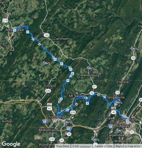
Day 3 – Tuesday, July 17, 2018 – Ohiopyle, PA to Meyersdale, PA
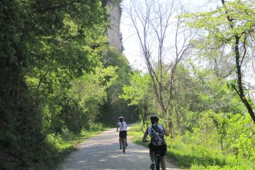
This was set to be the longest ride of the tour — 42 miles — and would end in Meyersdale. Meyersdale is a town that I’d passed before on the 6-day route, but had never had a chance for more than a cursory glance as we rode by on our way to Frostburg, and I was anxious to take a look at the town itself. Unfortunately, our luck with the weather ran out; it wasn’t raining as we readied our bikes in the parking lot of Wilderness Voyageurs, but the minute I started out to pick up the trail it began a steady drizzle that quickly turned into a light rain. Out came my rain jacket and shoe covers, but I knew what was ahead and just put my head down and rode on up the trail.
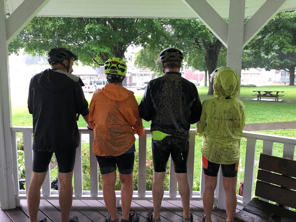
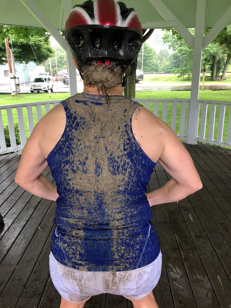
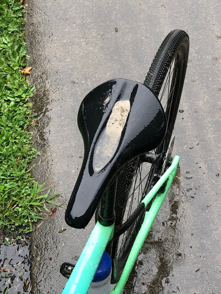
Our morning break was to be at Confluence, where we would also leave the Youghiogheny and head up the Casselman River. As I turned off the trail to cross the foot bridge over to Confluence, the skies really opened up. This was enough to put me off riding the next section, but I rode on into the town square to where our guides had set up some refreshments under the gazebo in the park. Everyone who came in — especially those without rear fenders or racks — was showing off their mud stripes, but we were expecting it and knew that it was all part of a typical bike tour. We had some time to look around the town while waiting to see if the rain would stop, and I found that the local bike shop was really quite nice and well stocked. I’m sure that he easily makes his annual budget from selling accessories and repair service to passing bicyclists.
As we were about to leave Confluence it did seem to clear up a bit and I thought that maybe I’d go ahead and ride the longish next segment, but my bike was already in the trailer so I got into the van where there were a couple of other riders who had not even started from Ohiopyle due to the rain. The trip in the van to the lunch stop in Rockford was an experience in itself, as the Garmin plotted a rather creative route that took us down a side road that turned to dirt and then narrowed to more of a goat path where we could not have turned around the van-trailer rig if we had to. Add in the heavy rain washing out the dirt on a couple of steep hills and it was something else! And with no cell signal (not unusual in this area) we were unable to get to Google to check exactly where we were. The guide who was driving later thanked me for taking over on the Garmin and verifying that we would indeed get there if we pressed on.
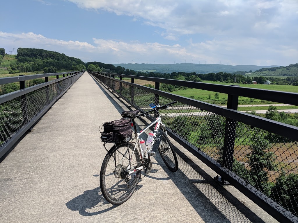
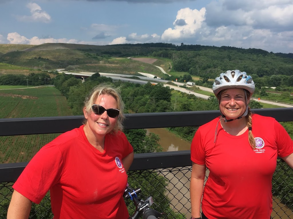
It turned out that those who chose to ride were rained on a couple of times even heavier than at Confluence, so I was not sorry to have skipped it. And by the time we all gathered and had our lunch, the skies were indeed clearing for good, with the heat and humidity breaking as well. So all but one of us proceeded on toward Meyersdale for a segment that was one not to be missed. The main attraction was the crossing of the 3500ft Salisbury Viaduct that carries the trail across a valley and over a main highway and a set of railroad tracks. In addition, a row of wind turbines were slowly turning on the ridgeline ahead of us, making for a beautiful picture against the now blue sky. It’s one of the signature features of the trail.
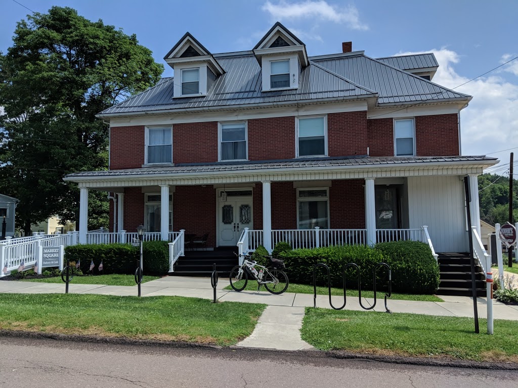
I turned out to be the first to reach Meyersdale, and turned off the trail downhill into the town to our night’s stop at Yoder’s Guest House. This is an old house that was taken over by a young couple and converted into an inn with 10 or more rooms, all with private baths. The owner became our instant friend when he brought out a cooler that was filled with bottles of craft beer plus some wine set on the table. Later we had a buffet dinner that was ordered in for us. He said that about 85% of his business comes from bike tourists along the trail. I had a neat little room that actually had its own “private entrance” off one end of the front porch, but my key gave me access to the main house in the morning where I went in and used the Keurig coffee maker that was conveniently located there. Again: a friend for life!

Day 4 – Wednesday, July 18, 2018 – Meyersdale, PA to Cumberland, MD
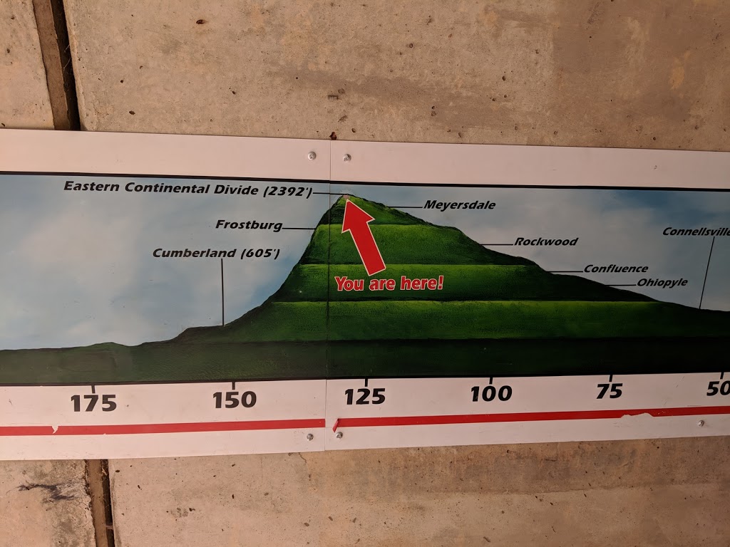
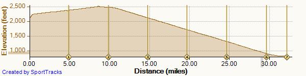
Even on a short trip with easy mileage, the last day of a tour always adds something extra, and in this case we had several things to look forward to: only 32 miles to go; perfect clear, cool weather without humidity; and 23 of the miles were significantly downhill. Especially over the past two days, we had actually been climbing steadily, but at a gradient generally less than 1%. Barely noticeable. But after crossing over the Eastern Divide, we would lose all of our gained altitude and more in the space of those 23 miles — almost two hours of barely having to pedal!
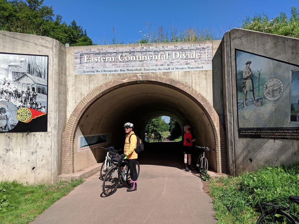
We left around 9AM again and headed up our longest “climb” of the day: the few blocks from Yoder’s up to the trail. From there it was just 7 miles to an early rest stop at Deal, and then barely one more mile to the official Eastern Continental Divide that separates the Mississippi watershed from that of Delaware Bay. From that point on, it was full speed ahead toward Cumberland!

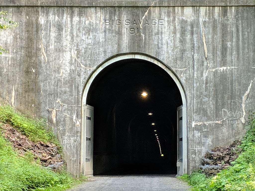
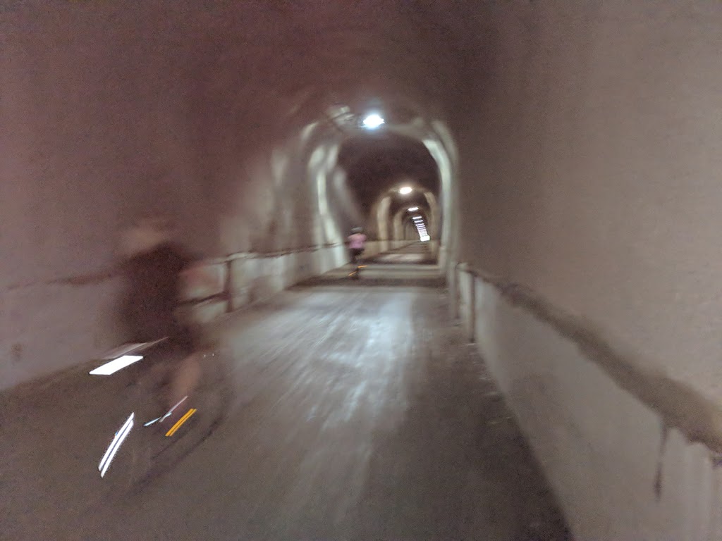
The first of three tunnels along the way is the famous 3200ft Big Savage Tunnel. This one is at least lighted (dimly) all the way through, but having a decent headlight is still a good idea. I can say from experience that it is very easy to become disoriented and lose your balance when the darkness of these tunnels swallows you up, even though you can see light at the other end. On my first trip down this trail, one member of our group fell in a tunnel and broke her wrist, ending her tour on only the second day. Coming out of this tunnel we were on the other side of the Allegheny range and were treated to a spectacular view of the bucolic farmland in the valley below — one of the best views of the trip.
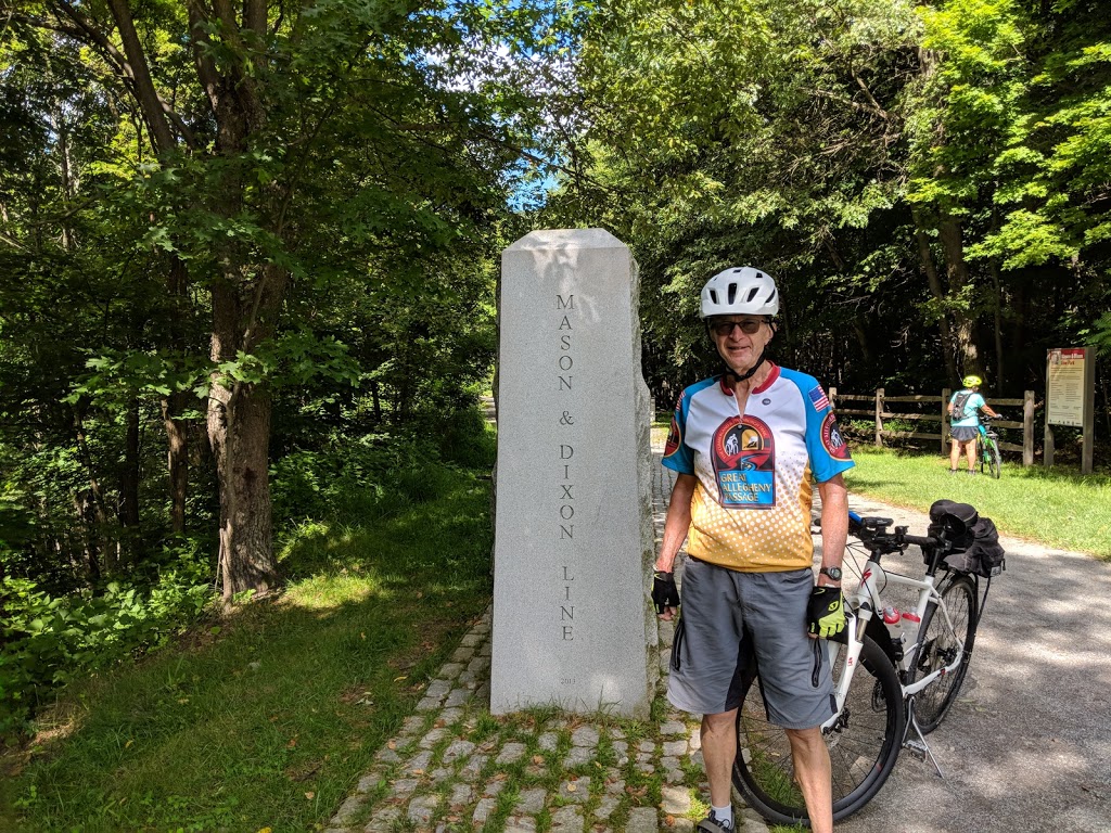
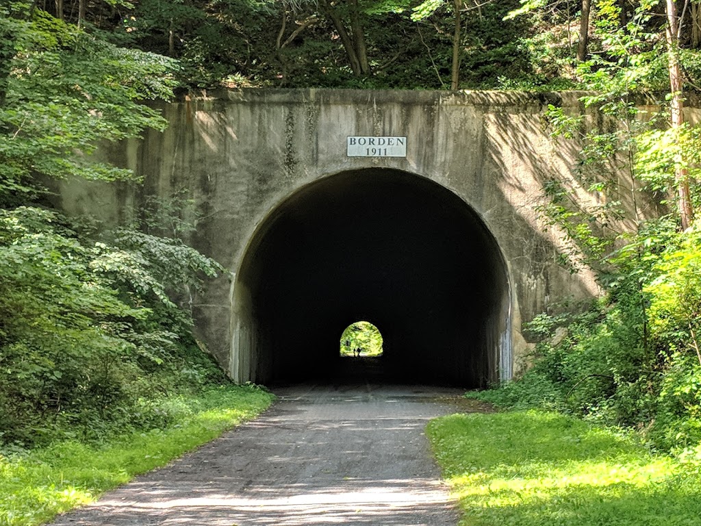
On the other side and down the hill a bit more we crossed the Mason-Dixon line into Maryland. There is a monument on one side and a symbolic surveyor’s chain over the trail that are worth stopping for. Then, the next tunnel — and the more dangerous one for not being lighted — is the shorter Bordman Tunnel. Again, having a good light aimed just 15 or 20 feet ahead will get you through without problems. As I proceeded downhill from there, I came to where the trail swept around a big bend at the Frostburg trailhead. Seeing the switchbacks that lead from the trailhead up to the town itself reminded me of the GAP-C&O trips where we stayed at the quirky Hotel Gunther up on top of the hill and how tough it was to get our bikes up there after a very long day of riding.
But this time there was no stopping and I zipped on down the grade. At this point, the trail is shared with an excursion railroad that brings people and bikes from Cumberland up to Frostburg during the tourist season. I’ve never seen a train on the tracks, but it sure would be a nice way to skip having to ride up this hill if you’re going east-to-west on the GAP! The bike trail has to switch sides with the tracks a couple times on the way down, and our guides had warned us to be sure to slow down and make the turns to cross the tracks at right angles; being in too much of a hurry could get you painfully dumped!
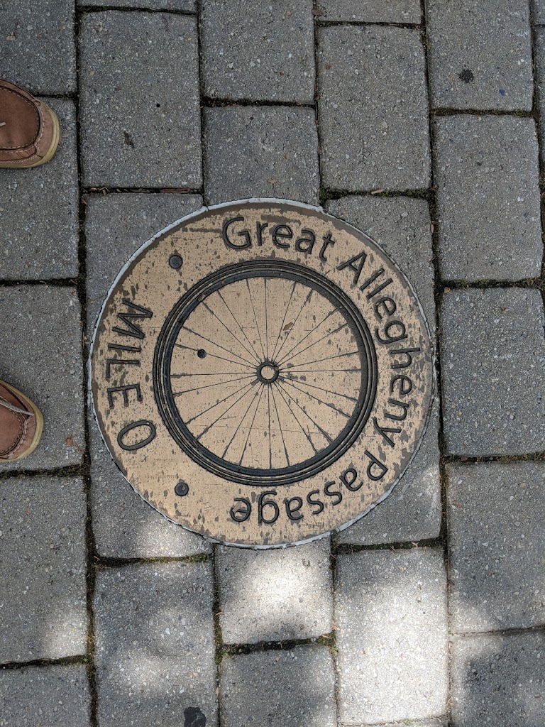
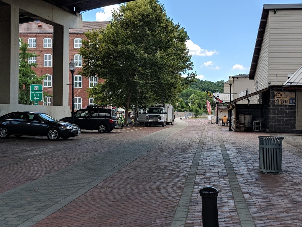
Finally, at the bottom of the hill we came into the city of Cumberland and proceeded down to the bricked plaza where the trail officially ends and the C&O towpath officially starts. We were there just after noon and Joe had our last lunch of the tour all ready for us. In addition, there were a number of tourist shops in the vicinity for those who wanted coffee, ice cream, bike accessories, or other souvenir items. We departed Cumberland at 2PM and were back at Voyageurs’ HQ by 3:30, giving us a good head start to get to our lodging or other destinations for the day. After saying my goodbyes, I departed for the turnpike and my night’s reservations in Cranberry Township on the other side of Pittsburgh. It had been a good farewell tour for me for riding the Great Allegheny Passage: a true world-class rail-trail and the “Ride of my Life!”
Wrap-Up
Looking back on this trip, it was a good way to wrap up my travels on the GAP-C&O corridor. Everything went well, it was a good group of people, and once again my trusty Crosstrail served me well. It did make me wonder how many more of these trips I have in me, especially since I can’t seem to convince any of my riding friends to give one of them a try.
Looking ahead to next year, both Wilderness Voyageurs and Carolina Tailwinds now have road-oriented tours in my home state of Michigan. Both are mostly on roads and trails that I have been on before, but it certainly sounds like it would be fun to revisit them on a higher-end tour and sleep in a luxury hotel room at the end of the day instead of being in a tent as in my earlier years of biking. They’ll definitely be on the top of my list when I start planning for 2019!
0 Comments