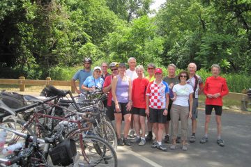
Monday, June 6, 2016

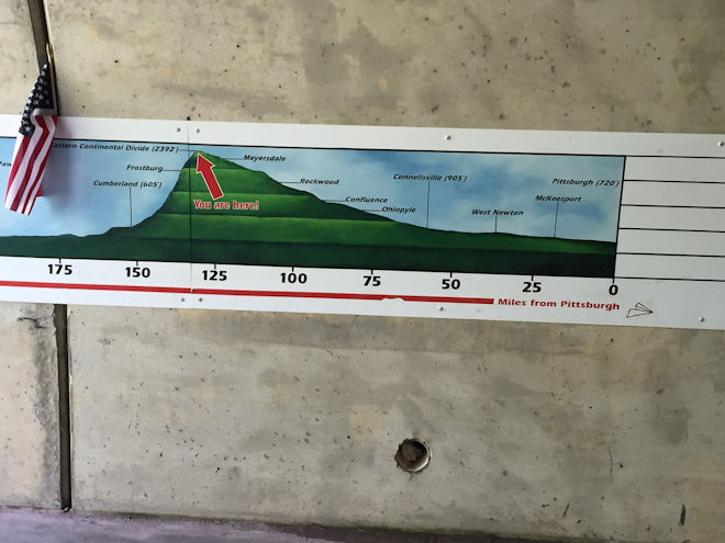
Today’s ride would take us on the more scenic stretch of the Great Allegheny Passage for about 57 miles, up and over the Eastern Continental Divide, and a little way down the other side to the town of Frostburg. Starting from Ohiopyle, we had about 1100 feet to climb to the divide, but over a distance of 50 miles it was only a max of about a 1% grade: not noticeable except for requiring a bit more pedaling effort.
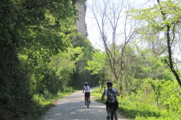
Starting back at the Voyageur’s home base, it was a really nice morning’s ride alongside the Youghiogheny with us on a rail-trail and a still quite active railroad line across the river. At the quaint, bucolic town of Confluence — so named because of the confluence of three rivers — we switched over to follow the Casselman River on upstream. Again I noted the beauty of all of the creeks and rivers that were in full flow from earlier days of rain, although thankfully it had cleared out by then.

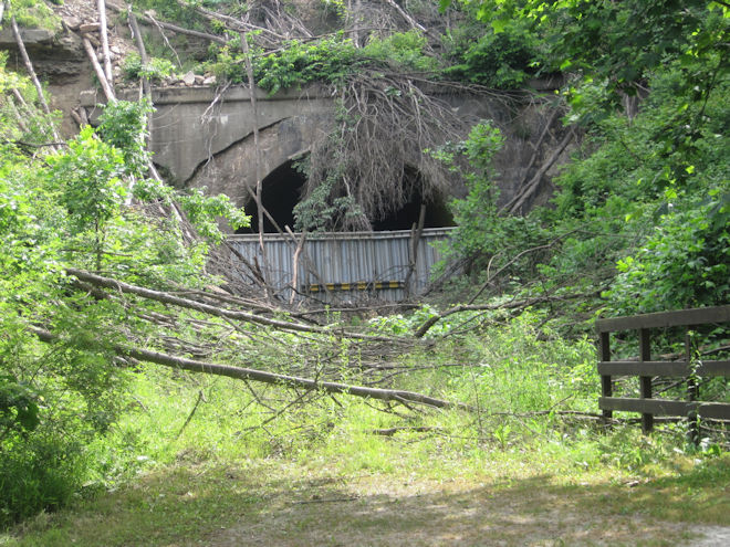
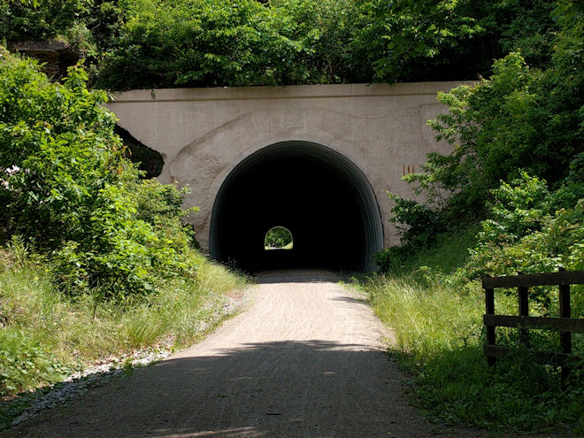
On the next stretch we encountered one of the places where the trail had changed since I was here in 2012. At that time, the Pinkerton Tunnel had not been opened for passage and we had departed from the main trail to take a bypass for about a mile to get around it. Now it had been cleaned out and opened up, so we were able to go straight through. On the other side of the river, there had been a similar tunnel on the active rail line that had undergone what they call “daylighting,” which is apparently a railroad euphemism for “blowing off the side of a mountain” to eliminate the tunnel altogether and allow the taller double-stack container cars to get through. This had been under construction in 2012 and was also now completed.
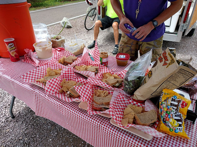
As on the other days, our trailside lunch a few miles past the tunnel in Rockwood was a real treat, featuring things like greens, pita bread, hummus, quinoa, and other “foodie” delights. This outfit had really separated itself from the typical “SAG stop” fare.
I had gone into this trip a bit concerned about being under-trained for consecutive days of riding and was starting to feel a bit worn out after two straight days of pedaling; the combination of the gradient and soft, rain-soaked surface was taking its toll. So I decided to skip the next 15-mile stretch and ride with Taylor to the afternoon support stop. This would mean that I’d miss both Meyersdale and the scenic Salisbury Viaduct, but fortunately I had ridden there on my previous trip.
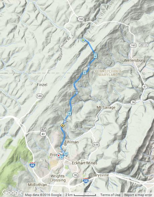
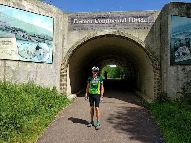
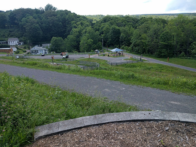
Picking up from the stop at Deal, I only had about ten miles to go to Frostburg, but these happened to be some of the most interesting miles of the day. First up was the Eastern Continental Divide itself, marked by a short tunnel with murals painted on the entranceways. At 2390 feet it hardly rivals the more famous divide in the Rockies, but it does serve to divide the waters of the Chesapeake Bay watershed from those going to the Gulf of Mexico. I remembered this as the place in 2012 where I had to fix the first of my flats, but this time I was on a bike with much better tires and things were holding up just fine. In fact, nobody on this trip had a flat whereas in 2012 it was rare for someone to not have had one.
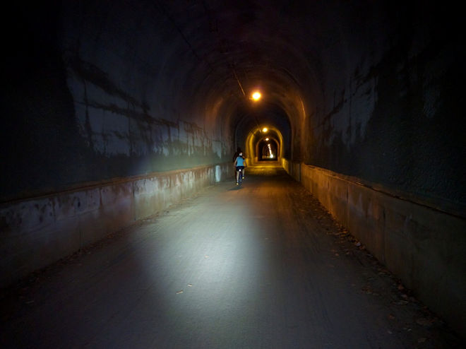
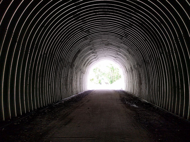
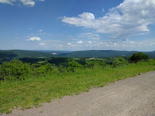
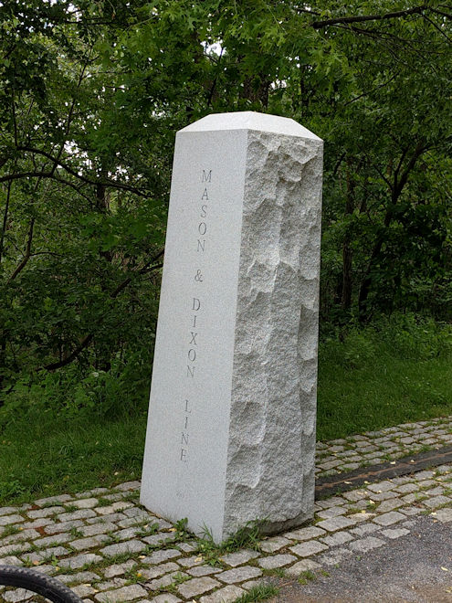
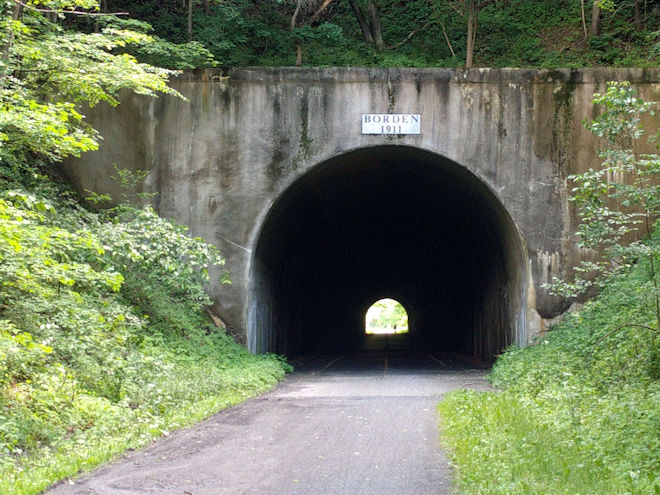
At this point, the trail started on a downgrade, and going from 2390 feet down to only 620 feet at Cumberland, that meant a good 3% grade or more for the next 25 miles, or in other words an easy, fast ride! Frostburg was eight miles along that stretch, but first we had to go through a couple of tunnels that required some caution due to their length. I had my own light, but the guides also had lights to install for those who didn’t have their own. Even though the 3300-foot Big Savage Tunnel is lit inside, it can still be dark enough to disorient a rider who goes in too fast and suddenly can’t see the trail very well in the dim light. The other side of the tunnel opens onto one of the more spectacular views of the trip where you are looking down from the height of the mountain to the flatter lands far below. After passing a marker that commemorated the Mason-Dixon Line — also the Maryland state line — this was followed a few miles later by the unlit Borden Tunnel where having a light is highly recommended. This run was a great way to end the day’s ride.
The city of Frostburg sits considerably higher than the trailhead, making for a tough climb up to street level, and the street to the hotel itself has a considerable grade to climb. Our guides had generously offered to meet people at the trailhead with the van and carry everyone and their bikes to the hotel — another service upgrade from my previous trip. This was tempting, but since I had taken a break earlier and ridden mostly downhill from there, I got to the trailhead ahead of the van and decided to go ahead and get to the hotel under my own power. I started by riding up a series of switchbacks that were made specifically for bikes to get up and down the hillside. The switchbacks were fairly easy, but when I hit the hills on the pavement there was no way I’d make it much farther, so I got off and walked. A couple of other early arrivals had done the same thing, so we walked our bikes up to the historic Hotel Gunter and crashed in the lobby with a cold beer until our luggage arrived.
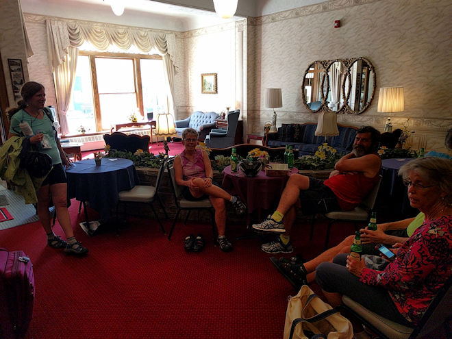
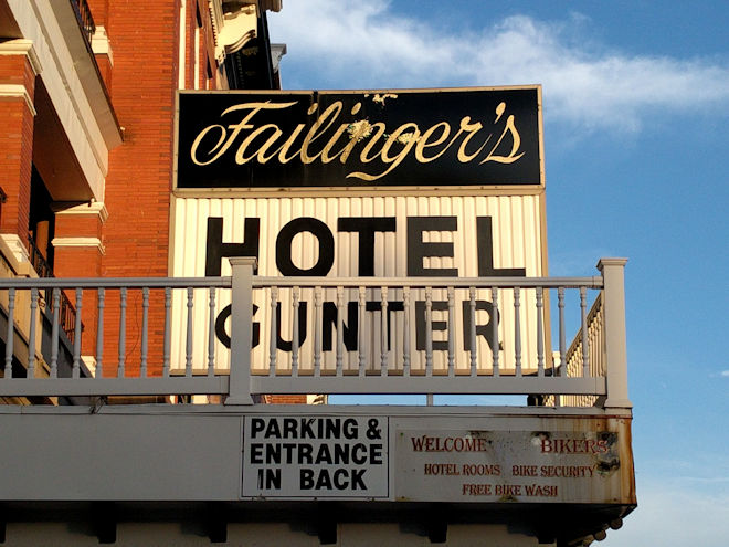
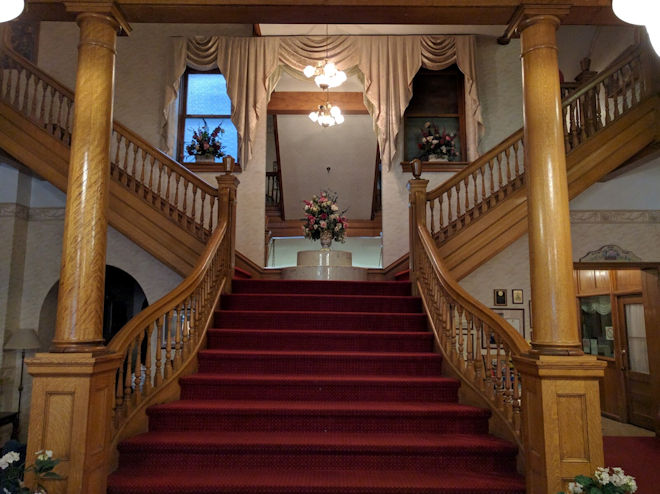
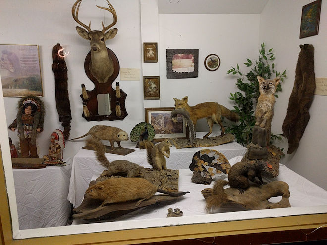
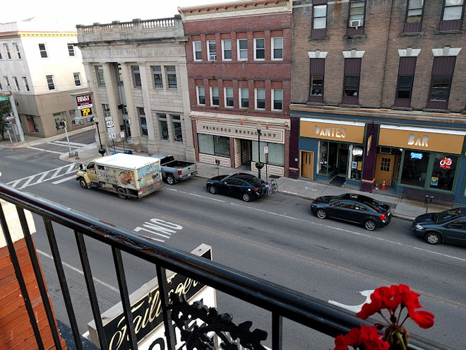
The Gunter was the most unique place that we stayed at on the trip, being a historic property and a real throwback to earlier ages of accommodations along the National Road (now US-40). The lobby has been beautifully restored and features a showcase of a staircase. The rooms are cozy but well equipped, and there is even a public balcony on each floor that overlooks the main street. The basement is a strange sort of historical museum with several display windows showing eclectic assortments of old items from dolls to medicine bottles. There is an old “coal mine” with underground tracks that were used long ago to bring coal into the hotel, and an actual jail cell for holding prisoners that were kept overnight while being transferred along the highway. This is one of the older settled areas in this part of the country, going back to when the original trail was blazed as “Braddock’s Road” during the French and Indian War of the 1750s, and later became a major route for the settling of lands in the west after the Revolutionary War.
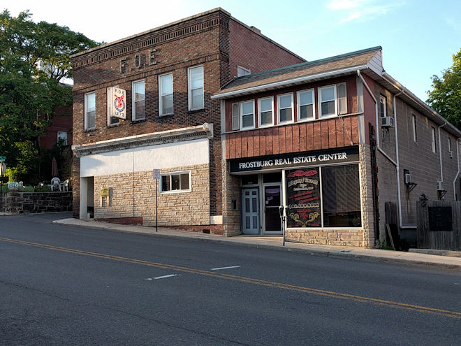
Dinner was on our own this evening, and about half of us ended up at a Mexican place down the hill from the hotel, after which we slogged back up the hill and pretty much turned in for the night. Our daily schedule was certainly full on this trip, and although we stayed on time, we certainly never had to go looking for things to do to fill up any “spare time.” And with all the extra work they had to do, I don’t know how our two guides managed to keep up with everything.
0 Comments