Tuesday, June 7, 2016
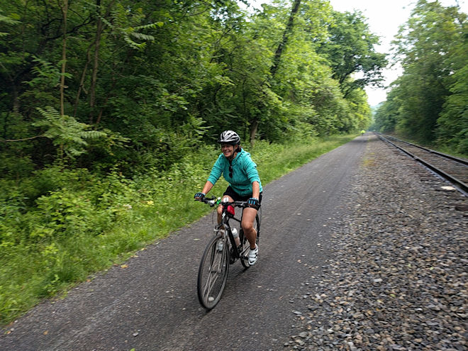
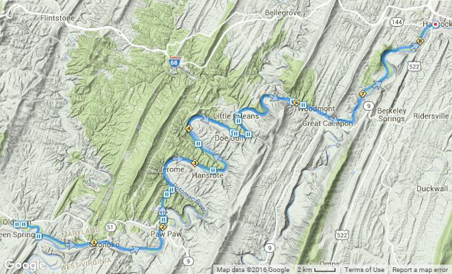
We had a long day in store. The C&O Canal Towpath Trail is much more isolated than the GAP trail with fewer places to get on and off or to find lodging, resulting in a long 77-mile route for the day. Fortunately this started with the first 16 miles continuing the fast downhill into Cumberland. On my previous trip, we had had lots of overnight rain in Frostburg and it continued for the ride to Cumberland, so I had been unable to enjoy it with my head down all the way. This time it was a lot more fun as the trail followed beside the tracks of the tourist rail line that goes from Cumberland up to Frostburg. I saw a few bikes who were traveling the trail in the other direction, and they looked to be working fairly hard as they tackled the 24 miles up to the divide.
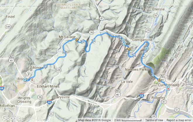
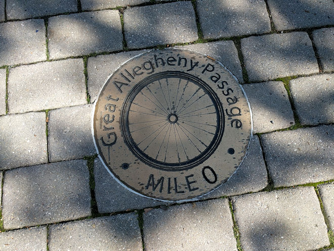
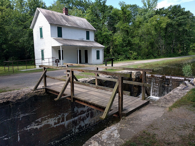
In Cumberland in front of the official Canal Visitor Center we found the Mile 0 marker for the Allegheny Passage as well as the mile 189 marker for the start of the towpath trail. This was also where I made a decision not to ride the upcoming 20-mile segment of the route. I was still concerned about my endurance, but even more than that I remembered that first part of the towpath as being extremely muddy after a rain, and even though we had not had rain the day before, this part of the country had been pretty well hammered with rain in the preceding weeks. We had even been warned by riders coming in the other direction that the C&O was a real mess. So I hitched a ride with Dave in the van to the lunch stop at the locks at Oldtown along the trail.
With over an hour to wait until our first riders would get there, I had an opportunity to observe other riders along the trail, some of whom we had seen on the previous days. There were a lot of people doing self-supported trips along the same route, some carrying full camping gear while others were taking the B&B option and had their gear in panniers and rack bags. Some of them might have stayed in the primitive “Hiker Biker” campsites that we saw along the way. All of them appeared to be a lot younger than the average age of our group, and there were a number of groups with fairly young kids, although those were mostly just along the easier and more populated GAP trail. One rider that particularly struck me was a young, slightly built Asian woman on a low-slung three-wheeled recumbent. It seemed like a singularly unsuitable mount for such a trail as the C&O, but every time I passed her along the trail, there she would be riding by again while I was at the next support stop. It really made me wonder who she was, where she was going, and why.
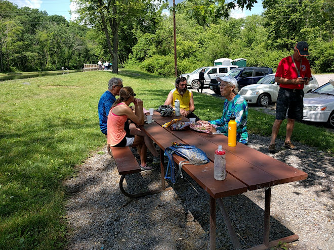
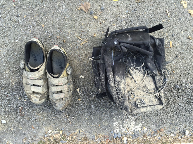
After everyone arrived and lunch was mostly over, I was itchy to get back on the bike. The others confirmed my guess about the trail, as everyone came in very muddy and generally complaining about the difficult riding conditions. I didn’t think it would be as bad from this point on, but I did expect to get muddy and put on my shoe covers. It was a good move.
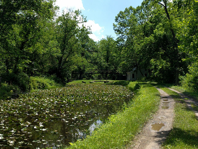
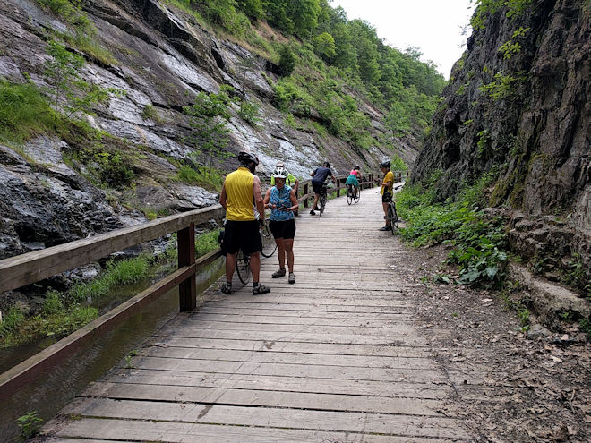
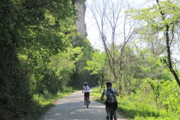
The C&O Towpath is a lot rougher of a trail than the GAP, being mostly a dirt two-tracker in appearance, with numerous depressions that don’t drain well and form muddy obstacles. At least it keeps your attention up as you look ahead on the trail to decide how to get past the next mudhole: go wide left or right to find a dry line, jump over to the other track, or give up and just go through the middle. I did some of each, which called for a lot of swerving. The mud guard again did its job, but I still ended up with a muddy bike and legs (but relatively clean shoes).
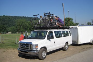
As can be seen on the GPS trace or a map, the canal closely follows the Potomac River, which really snakes around in its upper reaches. To go something like 30 miles as the crow flies must have been 40 or more miles on the trail. Our general direction towards Washington was southeast, but whenever I looked at the compass on my Garmin there was no telling which direction I’d be going at any given moment, sometimes even in the complete opposite direction! One of the nice amenities that Voyageurs supplied was a small Garmin GPS with pre-loaded route maps for everyone, which is a lot better than the simple verbal directions that we’d received in 2012. In general it’s simply a follow-the-trail tour, but the GPS assistance came in handy in some spots, such as when entering Cumberland and later Georgetown. Since I have my own Garmin, they had sent me the course files in advance so that I could put load them onto my device; it worked well.
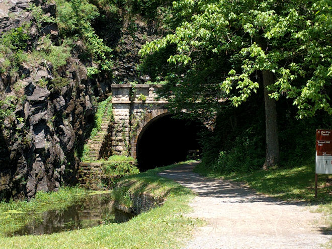
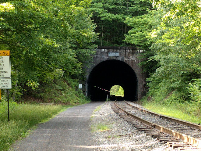
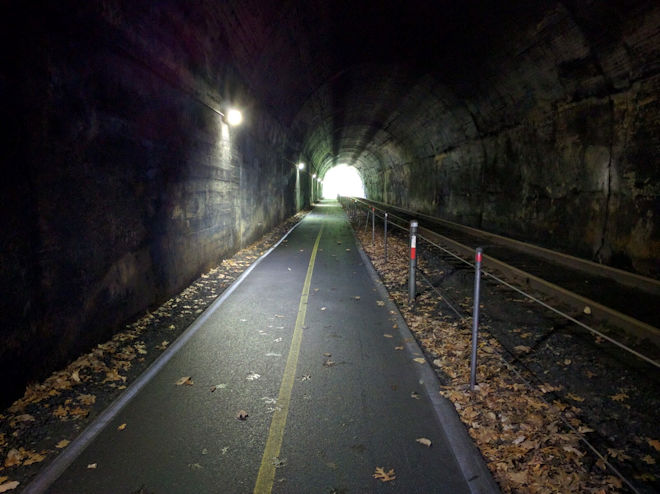
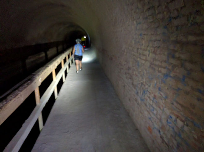
A little way from the lunch stop we came to the famous Paw Paw Tunnel. Hacked and blown through solid limestone, this 3100-foot tunnel took the canal builders fourteen years to complete and almost bankrupted the company. It is of course a tunnel to carry canal boats, so is mostly filled with water and has a narrow ledge on one side used by the mules to pull the boats through. Although it might be possible to ride a bike through — and I’m sure it’s been done — it is highly inadvisable! It also requires a headlight or flashlight since it’s not lit and and more than a half mile long. So we slowly walked our bikes along the ledge. This was my first time through the tunnel since on the previous trip I had opted out of doing this part of the day’s route due to the earlier mud and general discouragement.
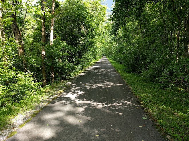
The last section of the day’s ride offered a welcome relief, as the towpath is closely paralleled by the smoothly-paved Western Maryland Rail Trail for the last few miles into Hancock. It was turning out to be a 57-mile day for me — not the full 77 but a good distance nonetheless — and the bike immediately sped up by a few mph when I got onto the pavement. At trail’s end right in town was the C&O Bike Shop where our bikes would be sequestered for the night, and there was Bill — first to get there on his and Mel’s tandem — handing out a cold beer. A great finish to the toughest ride of the tour.
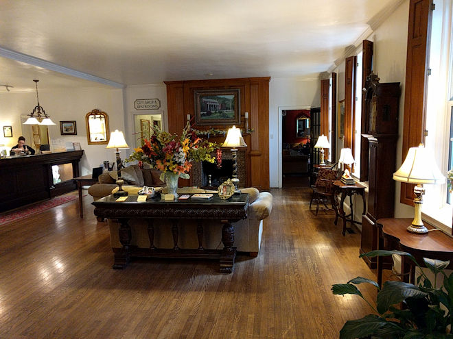
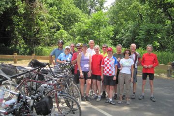
We all piled into the van and drove across the bridge into West Virginia to the town of Berkeley Springs and the upscale Colonial Inn. After getting checked in and cleaned up, text messages started flying around about everyone getting together at the guide-recommended Tari’s for dinner just down the street. All 12 of us made it there and shared a good meal and a lot of laughs while recounting the day’s events. We were having such a good time that it was hard to believe that we were already halfway through our journey by time and more than halfway by distance.
0 Comments